| Home > Articles > Weather N°1: Mediterranean winds |
|
Mediterranean winds |
1) MISTRAL (NW):
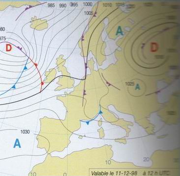
It is a flow of cold air of NW, Atlantic origin which, while being channeled between the Pyrenees, the Central Solid mass and the Alps opens in range, on the Gulf of Lions. The traditional conditions which generates it are the presence of a high pressure area on the SW of France, combined with the presence of a depression on the Mediterranean. The Mistral blows then in the West of this depression, and is more or less strong according to the difference in pressure which there exists between the anticyclonic and depressionary zone. Four types of Mistral are counted:
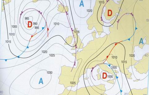
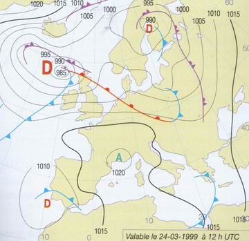
a) Generalized Mistral: it is a flow of NW which interests all Western Europe and the Mediterranean. It is more frequent in Winter and in spring. In this case, one can observe a trough of low pressure on the Central Europe and a vast high pressure area which generally extends from Azores in Spain.
b) White Mistral: Most
characteristic of the summer, the sky is clear, the air is dry. A
cold face penetrates on the Mediterranean, and a depression is formed on Tirreno
Settentrionale (Tyrrhenian Sea (name given to the piece of sea which
separates Corsica from Tuscany).
c) Black Mistral. The sky is covered with low clouds, with some storms (typical
of a flow of cold air of polar NW of origin).
d) Local Mistral. It blows moderately on the
Northern part of the Gulf of Lions when time is not disturbed and the
differences in pressure are weak. And becomes stronger by place, thanks to
a heating effect and orographical (related to the relief, example: the wind
accelerates between two valleys).
2) TRAMONTANA (N-NW):
The Tramontana is a cold wind, of sector N-NW which can blow at any season with violent gusts (especially with the outlet of the valleys). Like the Mistral, it can be presented under a clear sky, in mode of time anticyclonic (clear Tramontana) or with cloudy sky and precipitations when it is associated a disturbed system (black Tramontana).
The strong Tramontana can succeed a strong mistral, or be associated a flow of Bora (wind of N-NE which blows on the Northern part of the Adriatic, crosses Italy and is engulfed on North East of Corsica and Sardinia. As for the Mistral and the Tramontana, one distinguishes dark Bora and Bora Clair.) In this case, one speaks about a mode of Grecale tramontana.
NOTA BENE:
a) Mistral and Tramontana indicate in fact two identical phenomena but in different places. By abuse language (in particular in France), that the wind is N-NW or W-NW one tends to speak about Tramontana (of the Pyrenees Orientales with Gard) and about Mistral (of Gard in the Alps Maritimes), whereas in Spain, one makes well the distinction between the wind of N-NW (Tramuntana) and wind W-NW (Mestral). When the wind is full West, one speaks about Ponent or Ponente in particular on the Sardinian and Corsican coasts.
b) According to the old ones, the Mistral (or Tramontana) would last according to cycles' of 3, 6 or 9 days. These cycles check some times, but do not allow the development of a general rule.
c) a saying affirms: "Mistral (or Tramontana) survey of night, lasts only today". There too, that is far from being checked at 100%.
3) GRECALE ():
It is generated by high pressures on
the Balkan Peninsula and of low pressures on the sea of Libya, it is engulfed by
the gulf of Embarrassment to extend on the Mediterranean. One speaks about
Grecale (Italy, Corsica, Sardinia); Gregal or Gargal (Catalonia), or of
Euraquilo or Euroclydon on the side of Malta.
4) LEVANTE (E):
It is the resultant of the introduction of high pressures on the Central Europe and the digging of a depression (on Spain or North Africa) which goes up towards Corsica or Italy. Causing a strong sea, a stopped sky and violent one storms.
5) MARIN (SE):
It is a hot wind is wet which is established by the digging of a depression in the Spain-Balearic Islands zone and which goes up towards the Pyrenees. It brings clouds which cover the reliefs by often giving weak rains to stormy.
6) SIROCCO:(S)
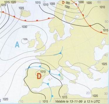
It is a hot and wet wind of Southern sector, which generally blows in Spring and in Autumn. It is generated by a Saharan depression which move towards North, and an anticyclone located at the East of the latter. The flow of hot air that it generates when it passes to the top of the sea, causes an intense evaporation. Thus the blows of Sirocco are accompanied by clouds, fogs (often yellowish) and rains being able to lead to violent one storms. You will notice that after a rain of Sirocco, one finds sand and ground come from the Sahara!!... When it blows extremely and in a constant way on the Northern Adriatic it causes the phenomenon "high" on Venice (the Venetian ones then find the feet in water...).
7) LIBECCIO:(SW)
It is a wind of SW caused by the entry of an Atlantic disturbance on the Mediterranean basin. It is more frequent in Autumn and Winter, where it can be transformed into Libecciata (Storm of sea of SW). Along the coasts provencales, one will tend to speak about Labbé or about Garbi in Catalonia to name this wind of SW.
Sources
- "the weather marinates" of Domenica the Brown one (Arthaud Edition)
- Charts of Weather France
- Meteosurf Forum (Paolo Bergamaschi of Tuscany)/Surftribe.it.
Willsurf66 All rights reserved Copyright since 2002